Infographics
Some recent examples of infographics I've worked on.
Personal Projects
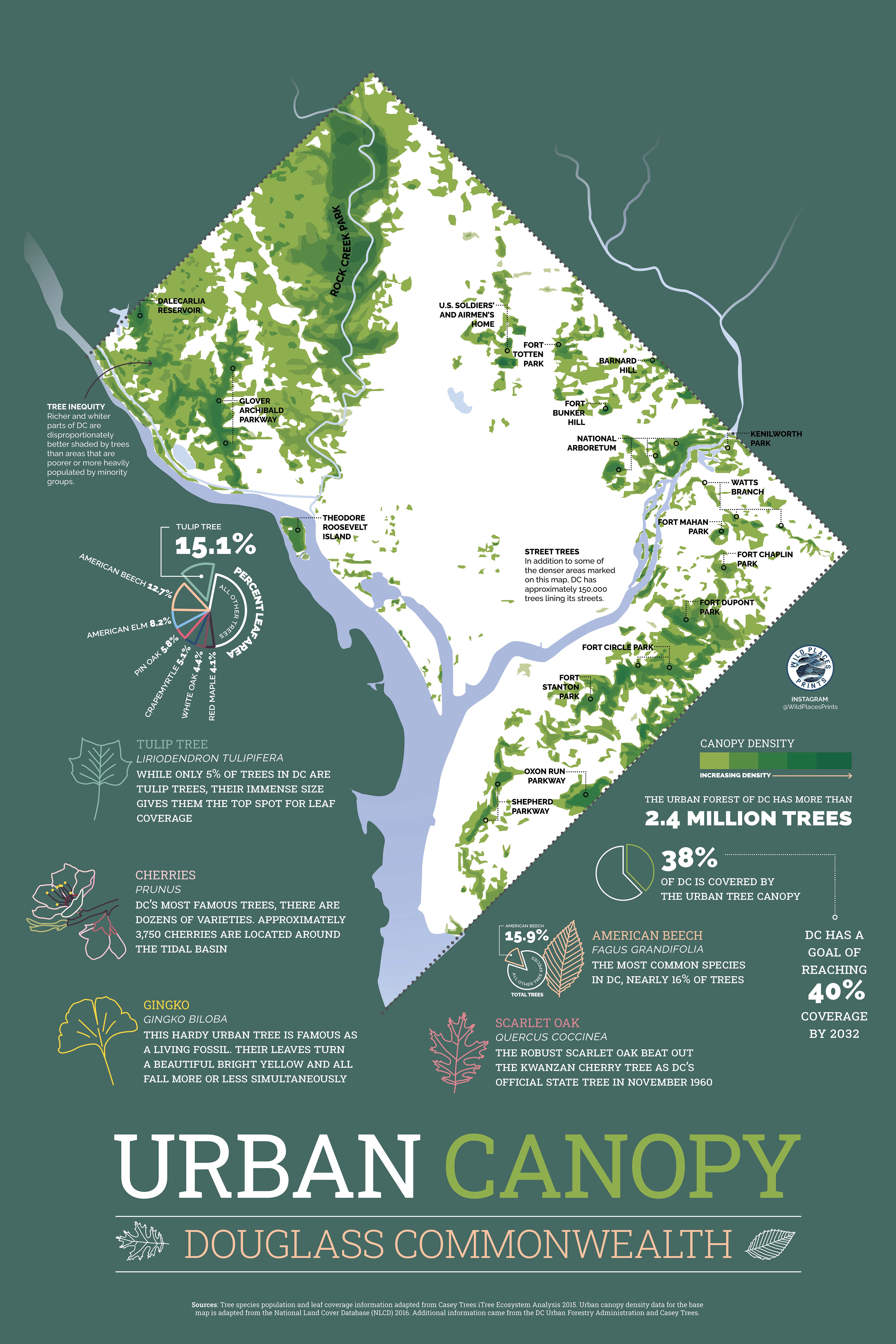
Some examples of infographic artwork projects that I sold full-time in markets in the Washington, DC area for about two years.


Client: iStation (Story of America project)
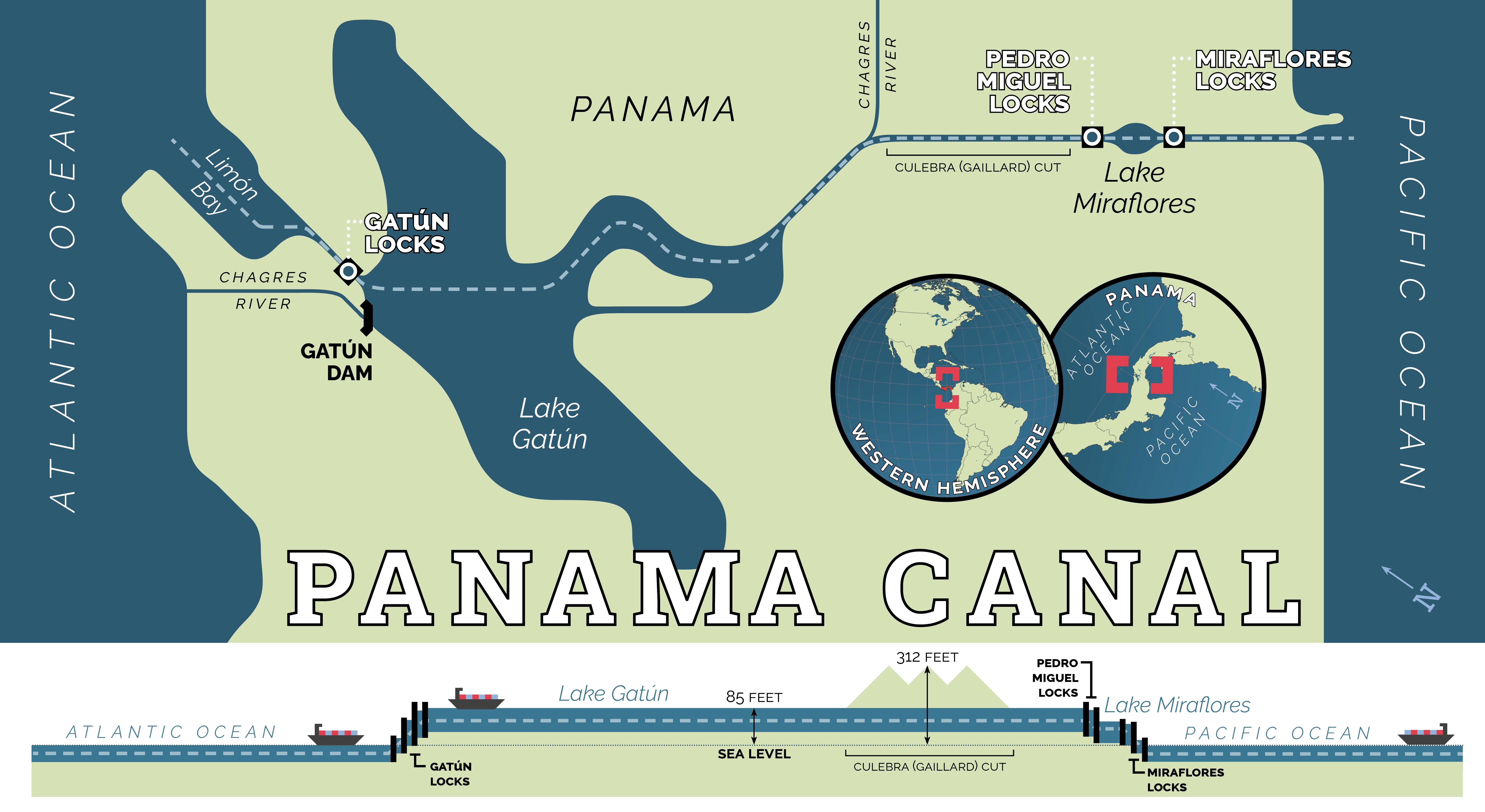
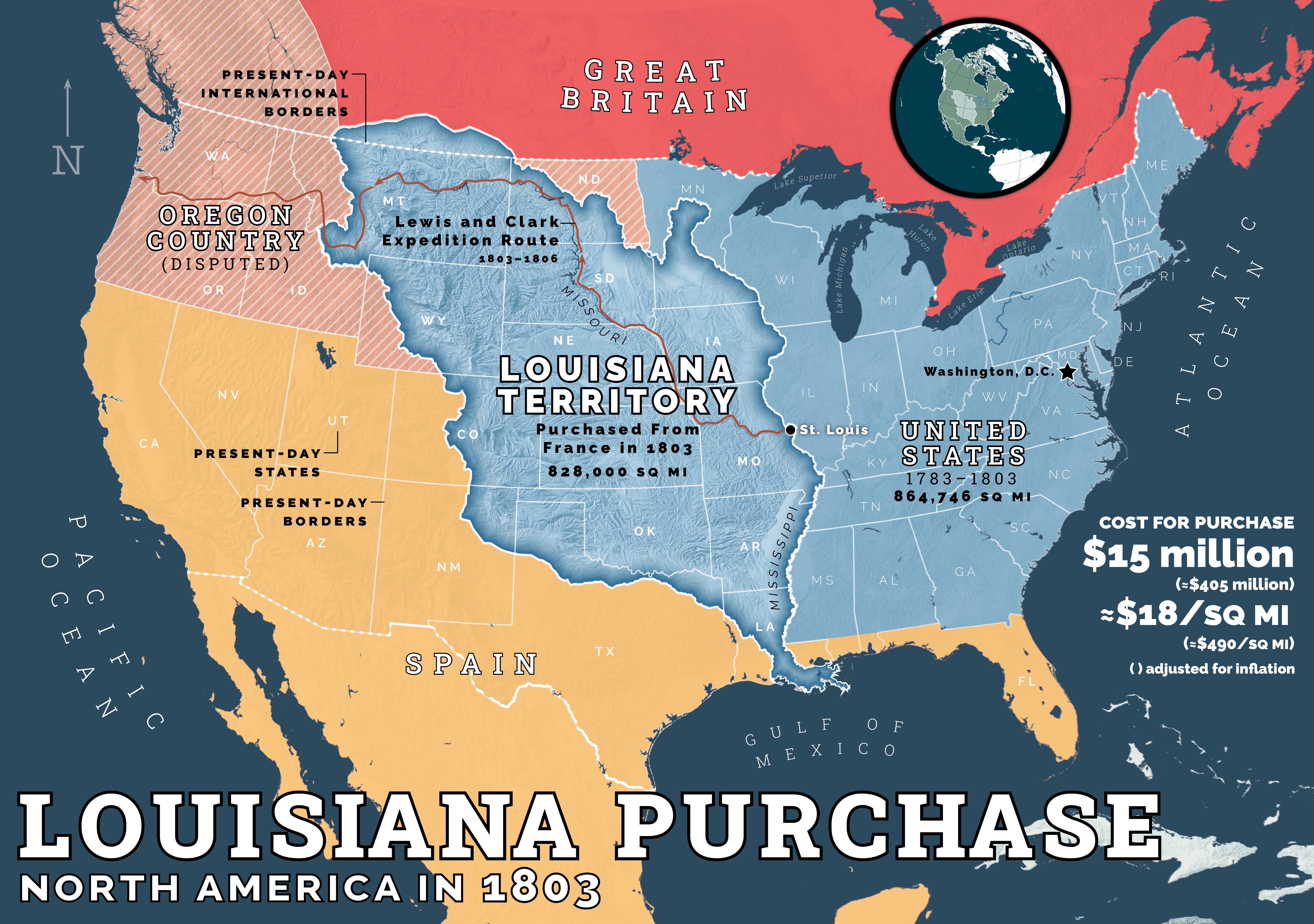
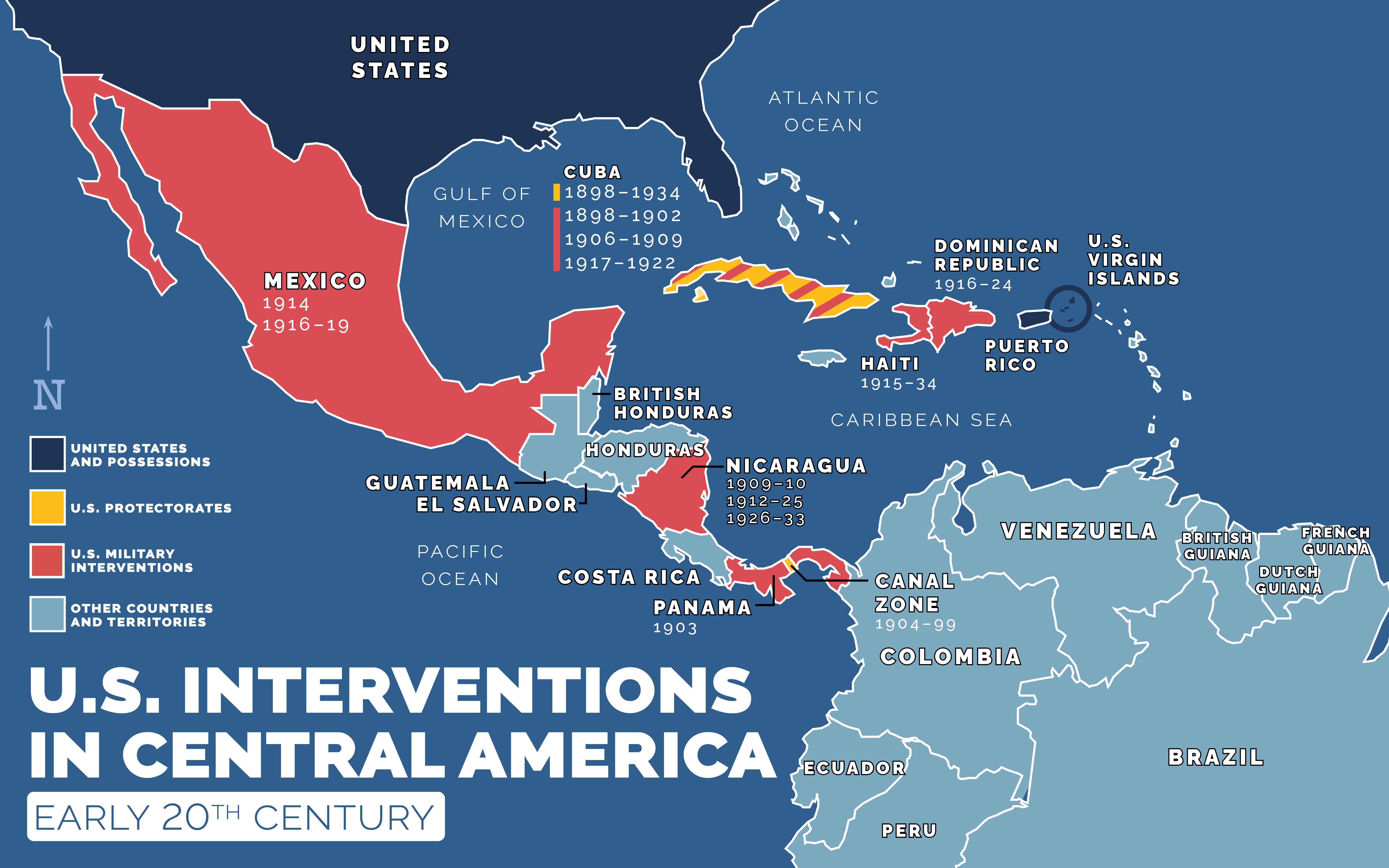
These infographics were all used in the Story of America project, a US history platform being rolled out right now in middle and high schools nationwide, and for which I was the lead educational map and infographics designer. Many of these were ideas I pitched and came up with on my own, based on the needs for each unit. These represent just a small snapshot of the hundreds of maps and graphics I did over a year-and-a-half-long period working on this project.
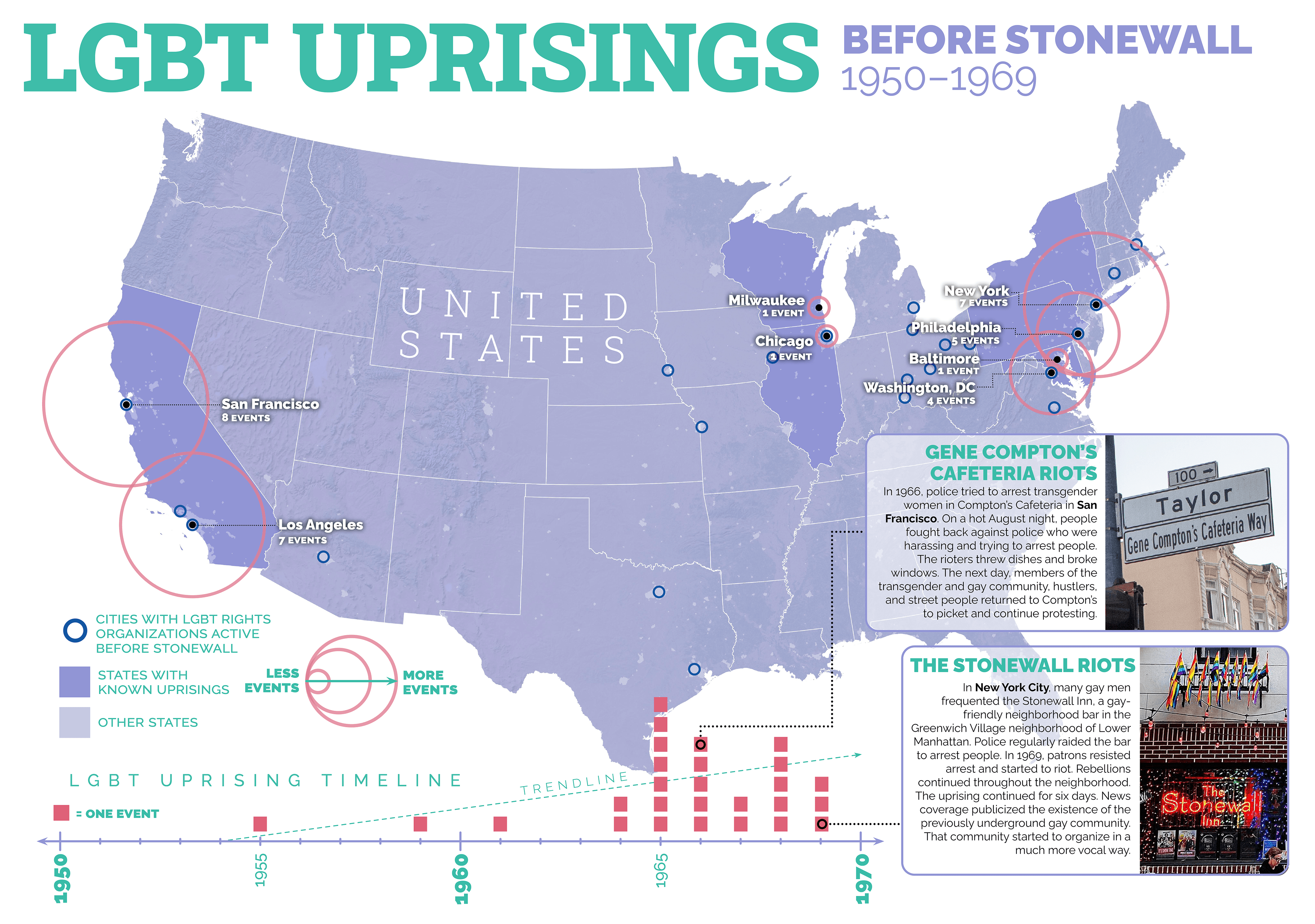
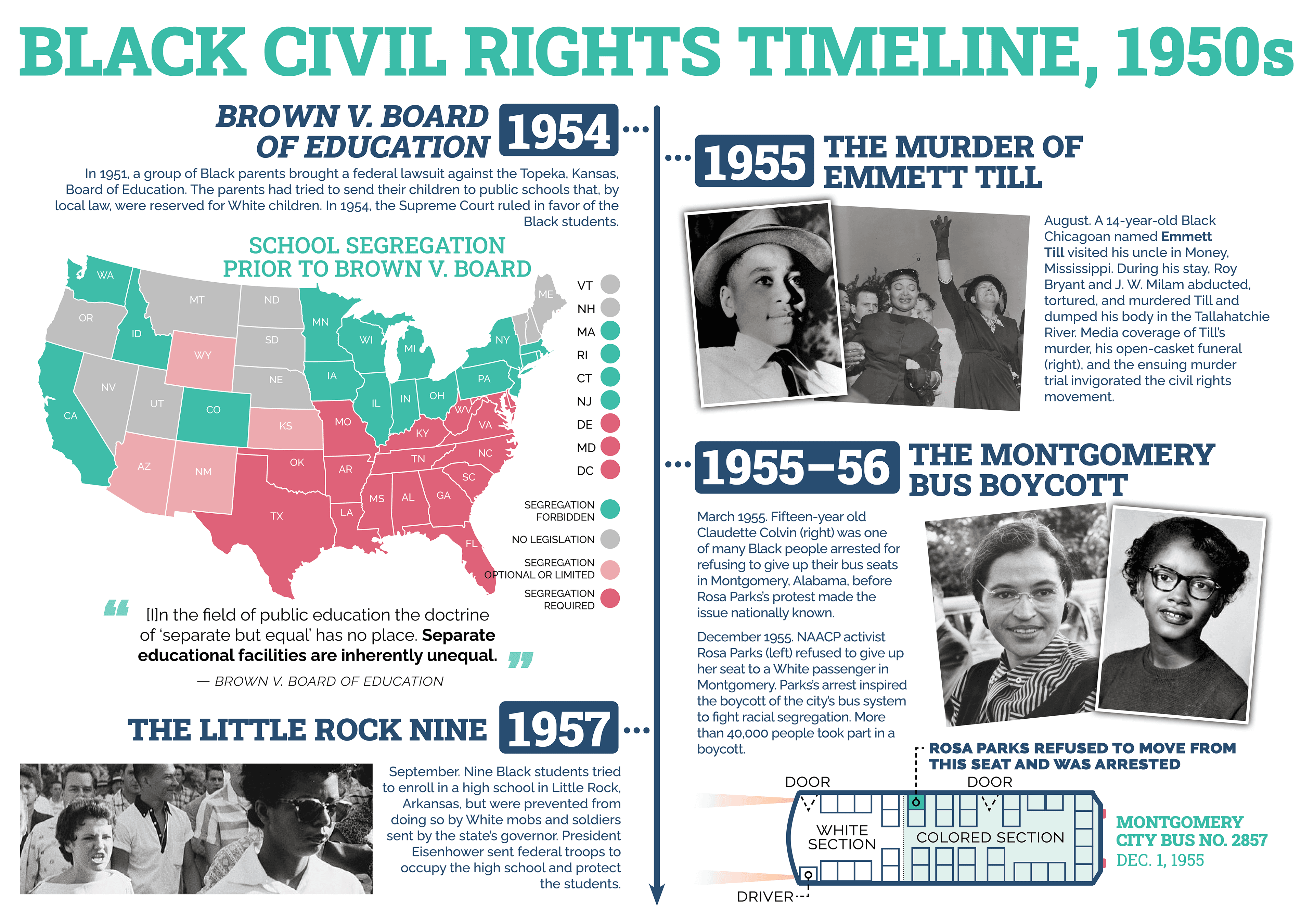
Civil Rights Infographics
Infographics made for the Civil Rights unit of the Story of America project
Mesoamerican Cultures Map and Timelines

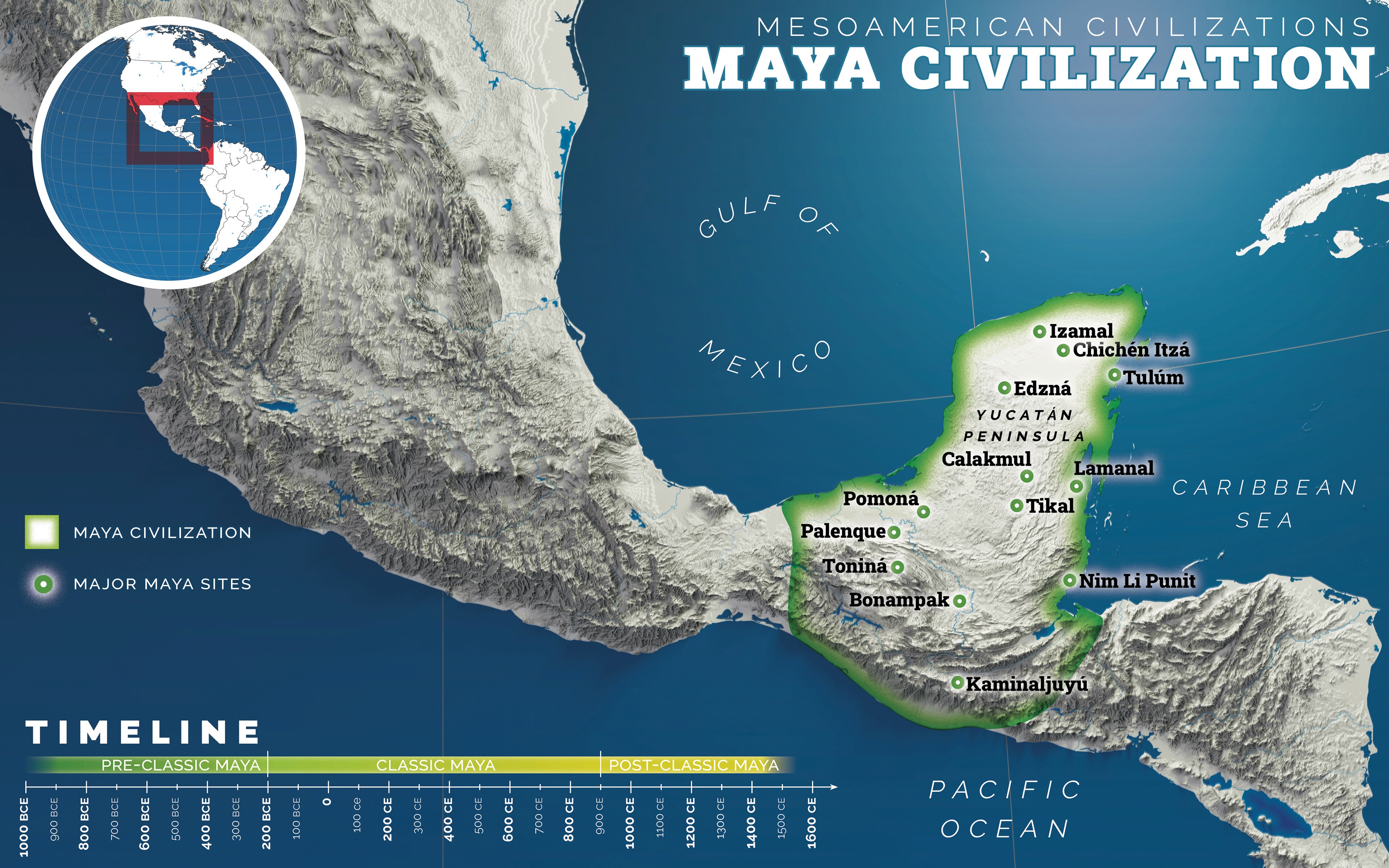
Pre-Contact Native American Cultures Map and Timeline
The script for this lesson initially called for a much simpler timeline and no maps for this topic. I pitched a much more expansive series of maps along with the timeline, which were approved and are in use in the Story of America program now.
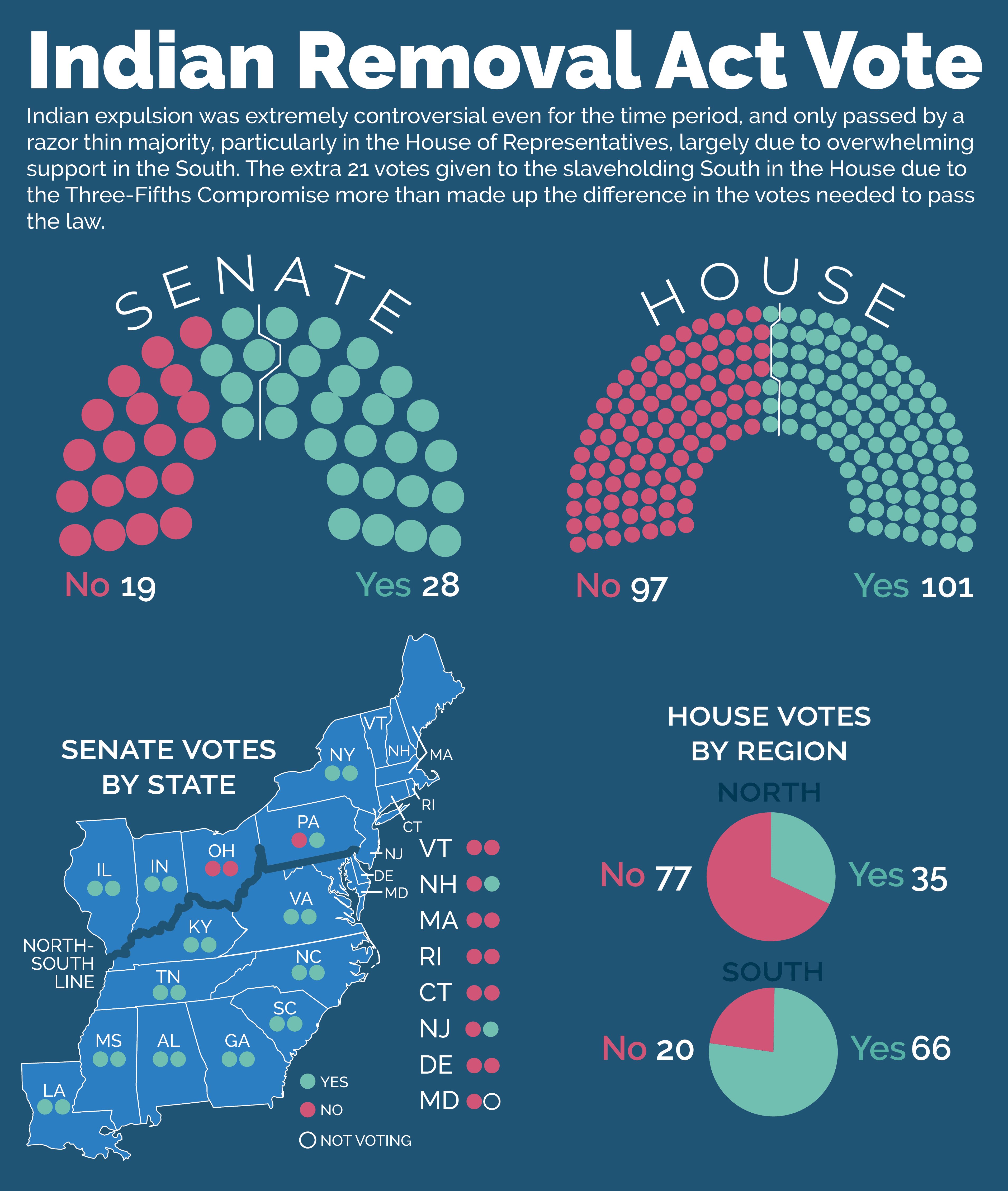
Broken Native American Treaties in the Early Republic
This infographic and map was entirely my own creation based on my own knowledge, and was used in the Story of America program.

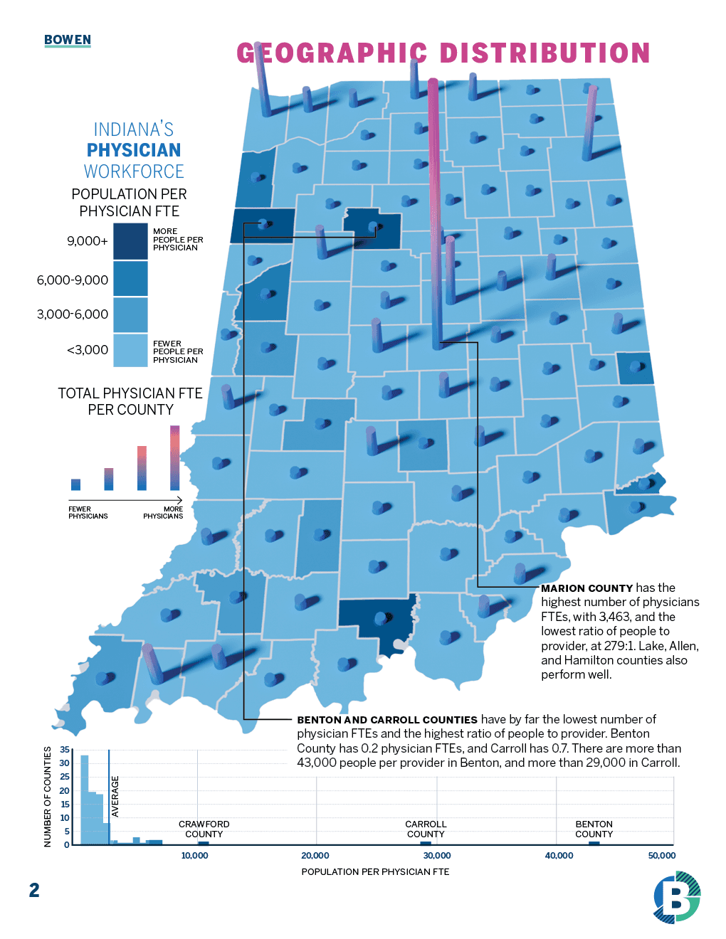
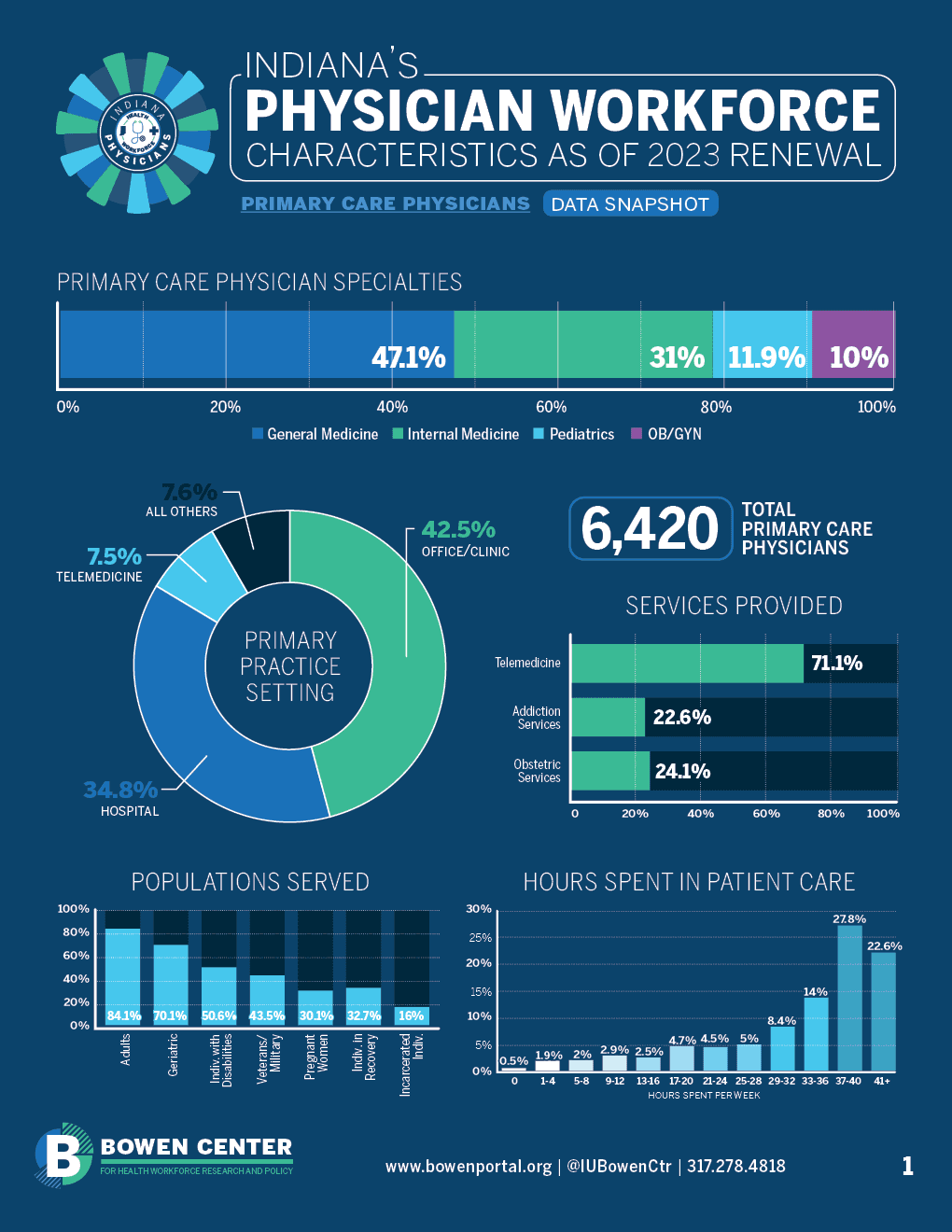
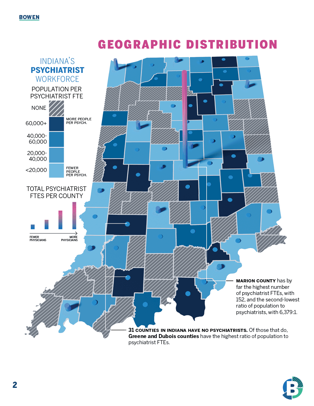
Indiana Physician Workforce Snapshot Infographic Redesign
Client: Bowen Center for Health Workforce Research and Policy


Other Infographics
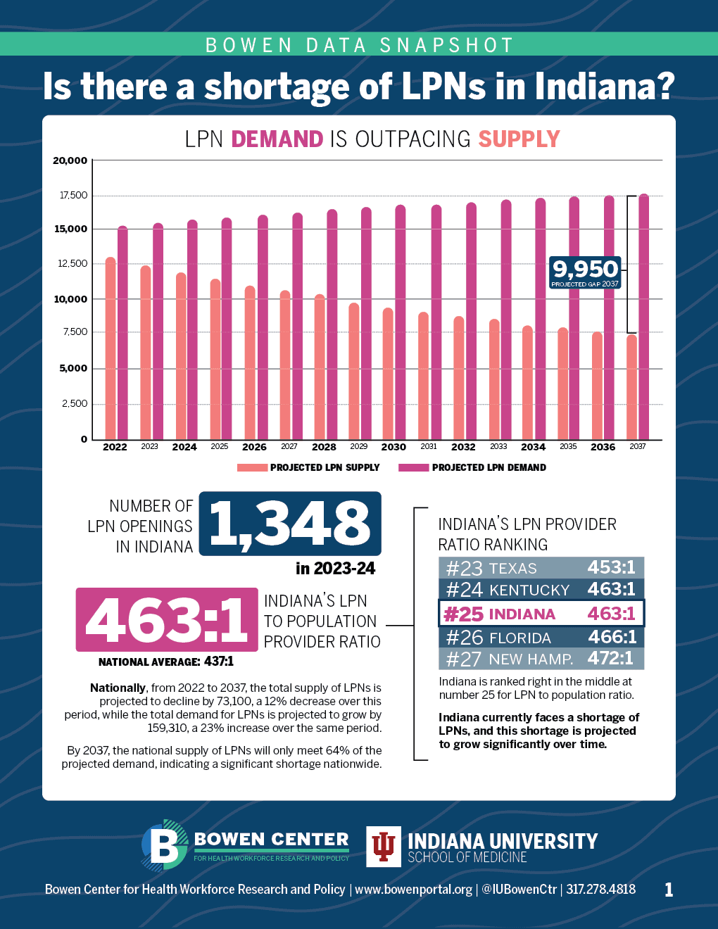
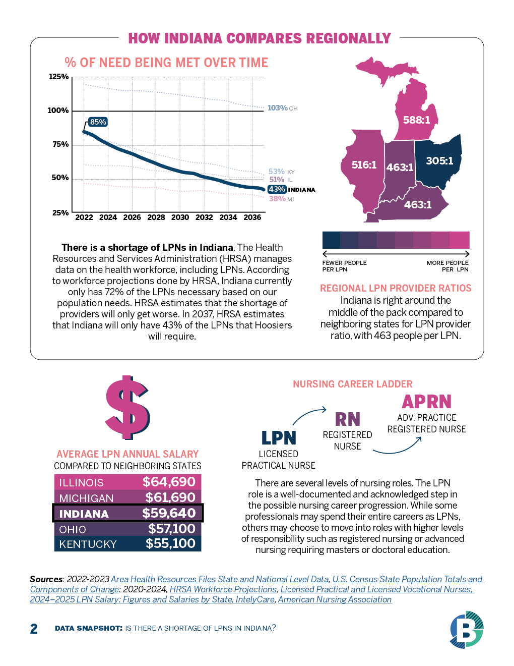
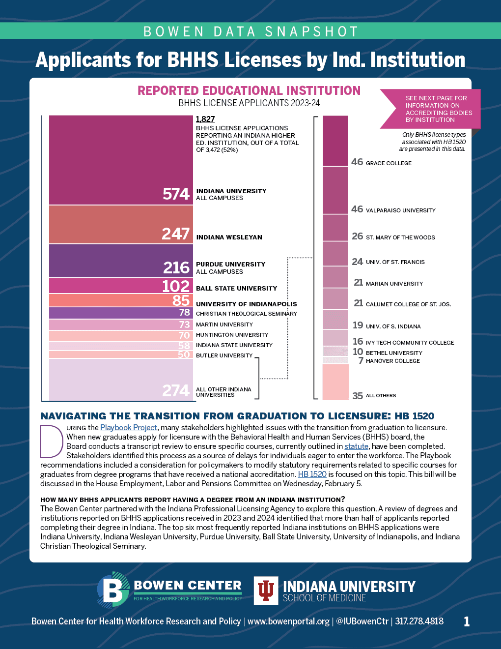
Live 2025 Indiana Legislative Updates
One-Pagers
Client: Bowen Center for Health Workforce Research and Policy
These infographics were made the day-of on tight deadlines based on the daily legislative agenda dealing with health workforce issues early in the 2025 Indiana Legislative Session.


Educational Infographics
Chesapeake Bay Ospreys: A Warning Sign for a Sentinel Species
Pro-bono work highlighting recent scientific studies about a decline in the osprey population in part of the Chesapeake Bay


A long-term project to map the known Nacotchtank sites in the present-day District of Columbia, which is the ancestral land of the indigenous Nacotchtank people, an ethnic and linguistic subgroup of the Pisctaway people, who still have thousands of living descendants in the DC area today. The goal is to acknowledge the fact that the land where the capital of the United States sits is stolen and once belonged to the Nacotchtank people, and to fill the relatively huge hole in the public's awareness and knowledge of this fact. This map is a work in progress.
Nacotchtank Mapping Project
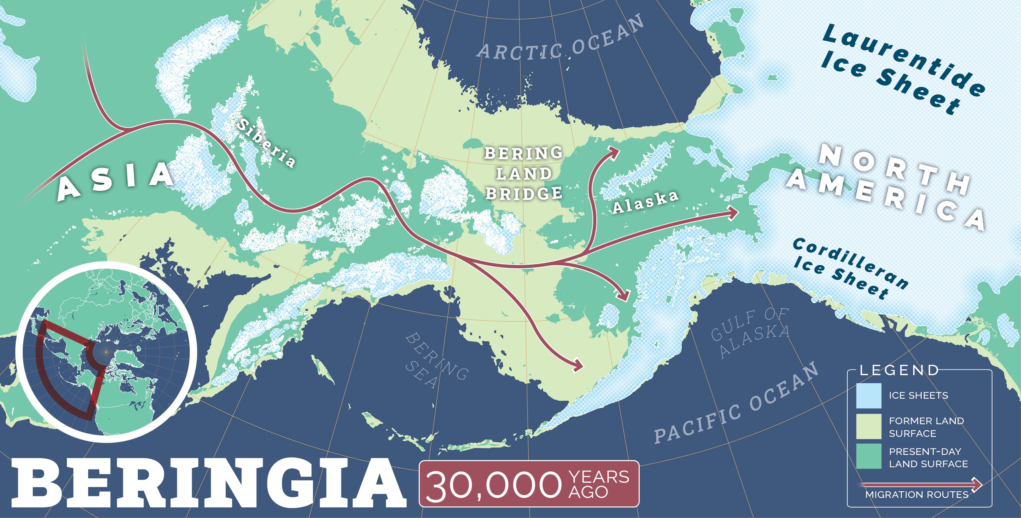
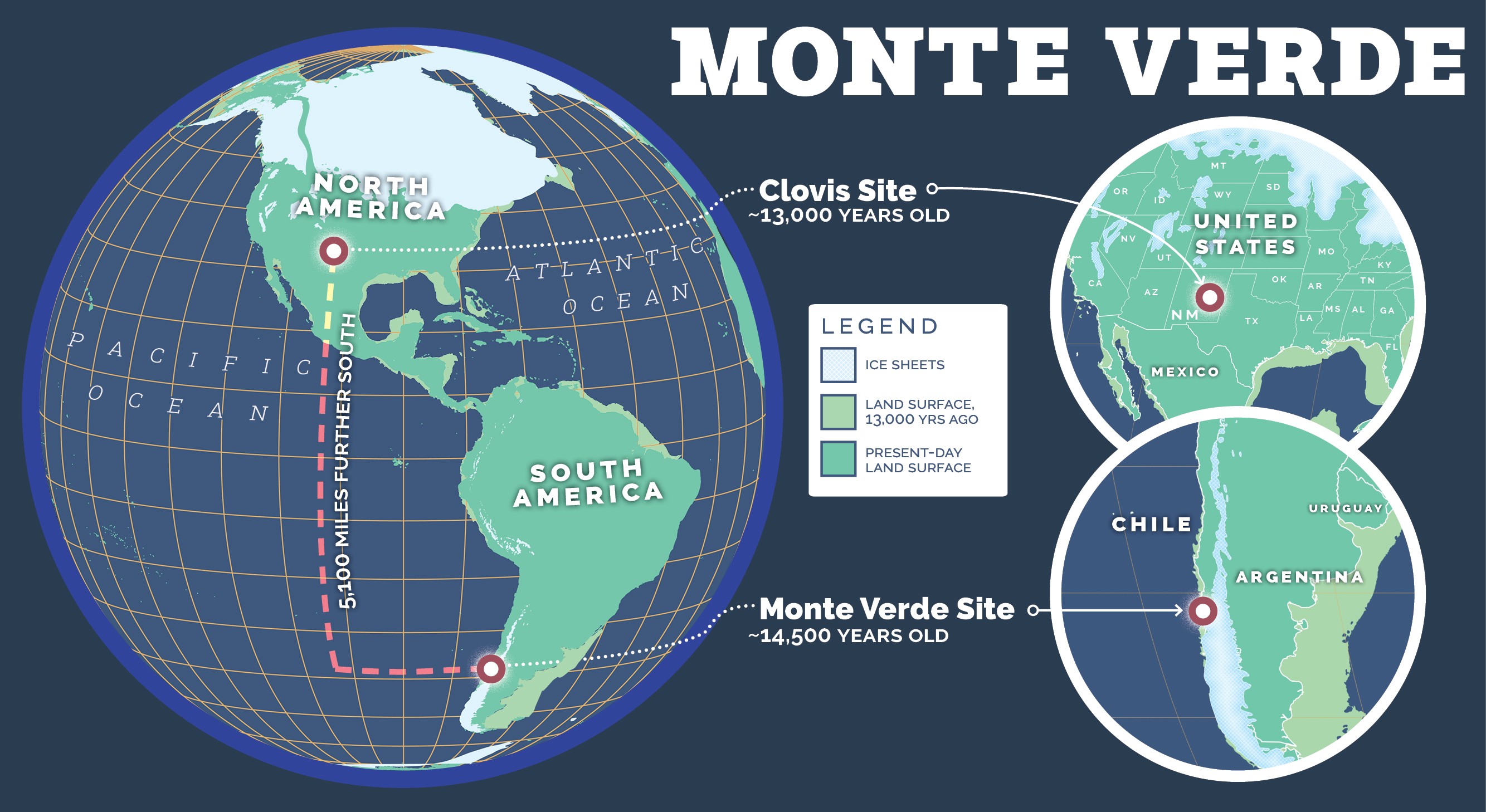
Peopling of the Americas Maps
One of my personal favorite historical subjects.


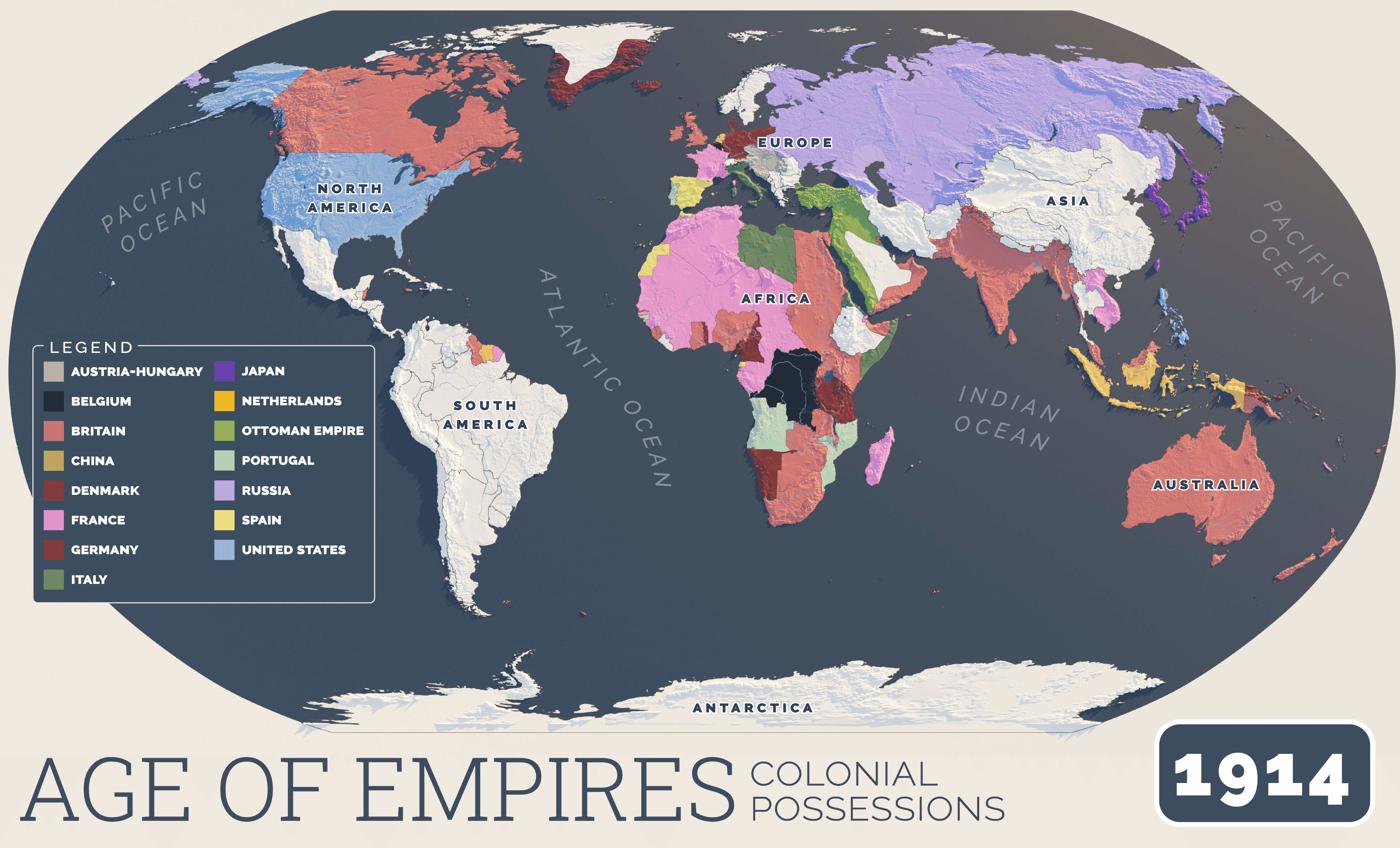
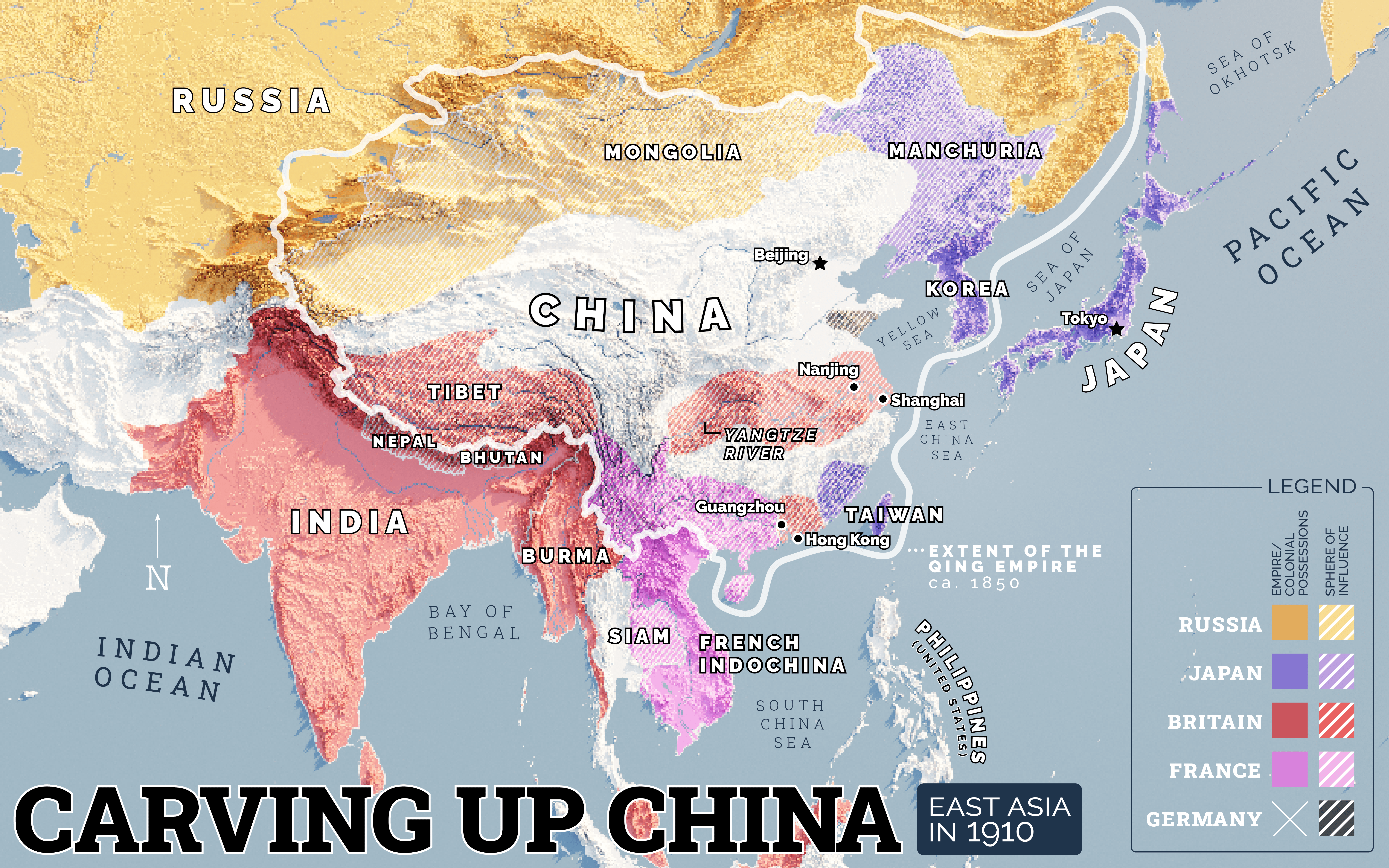
Other educational infographics
A somewhat random sampling of other educational maps and infographics I designed for the Story of America project.


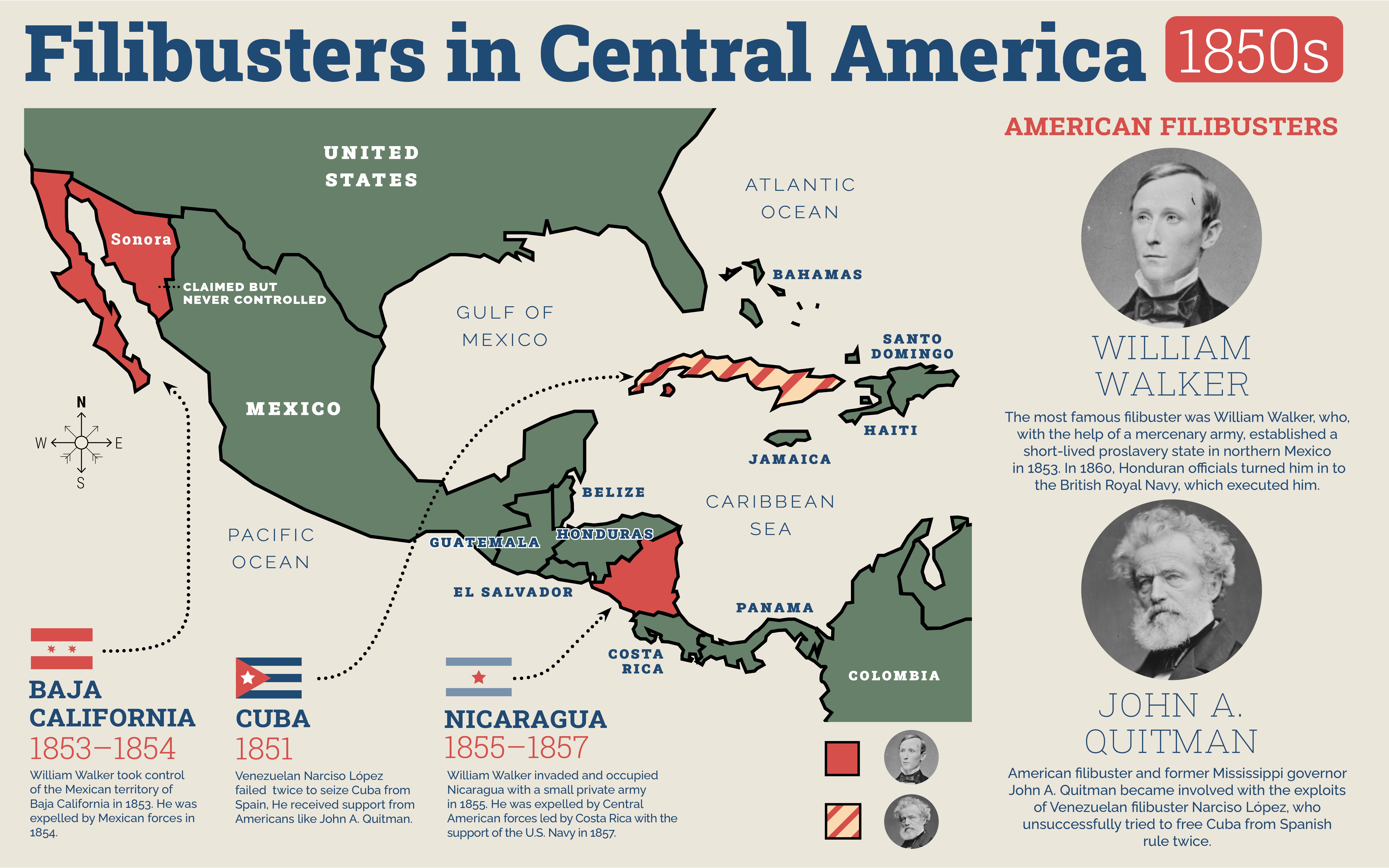

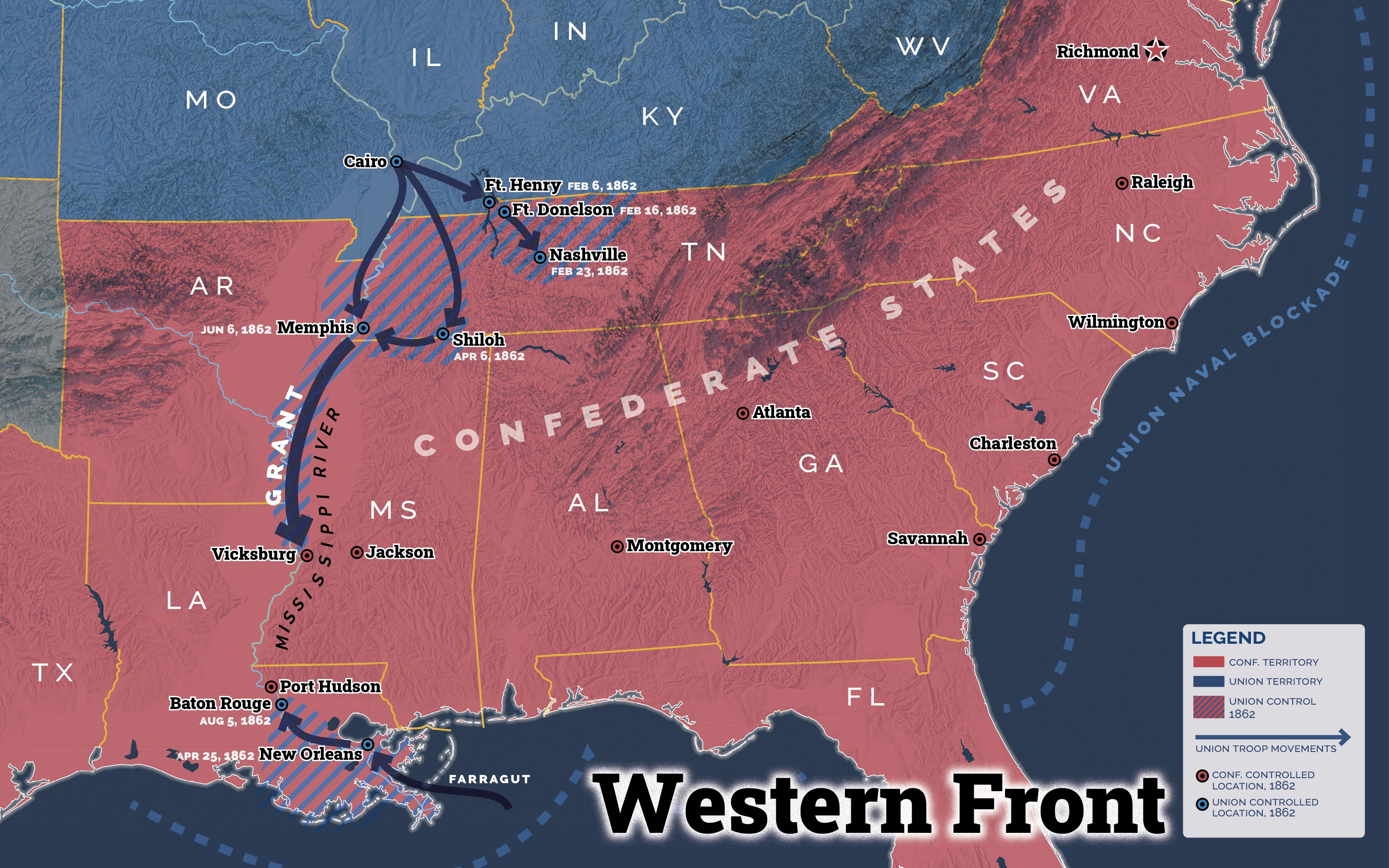
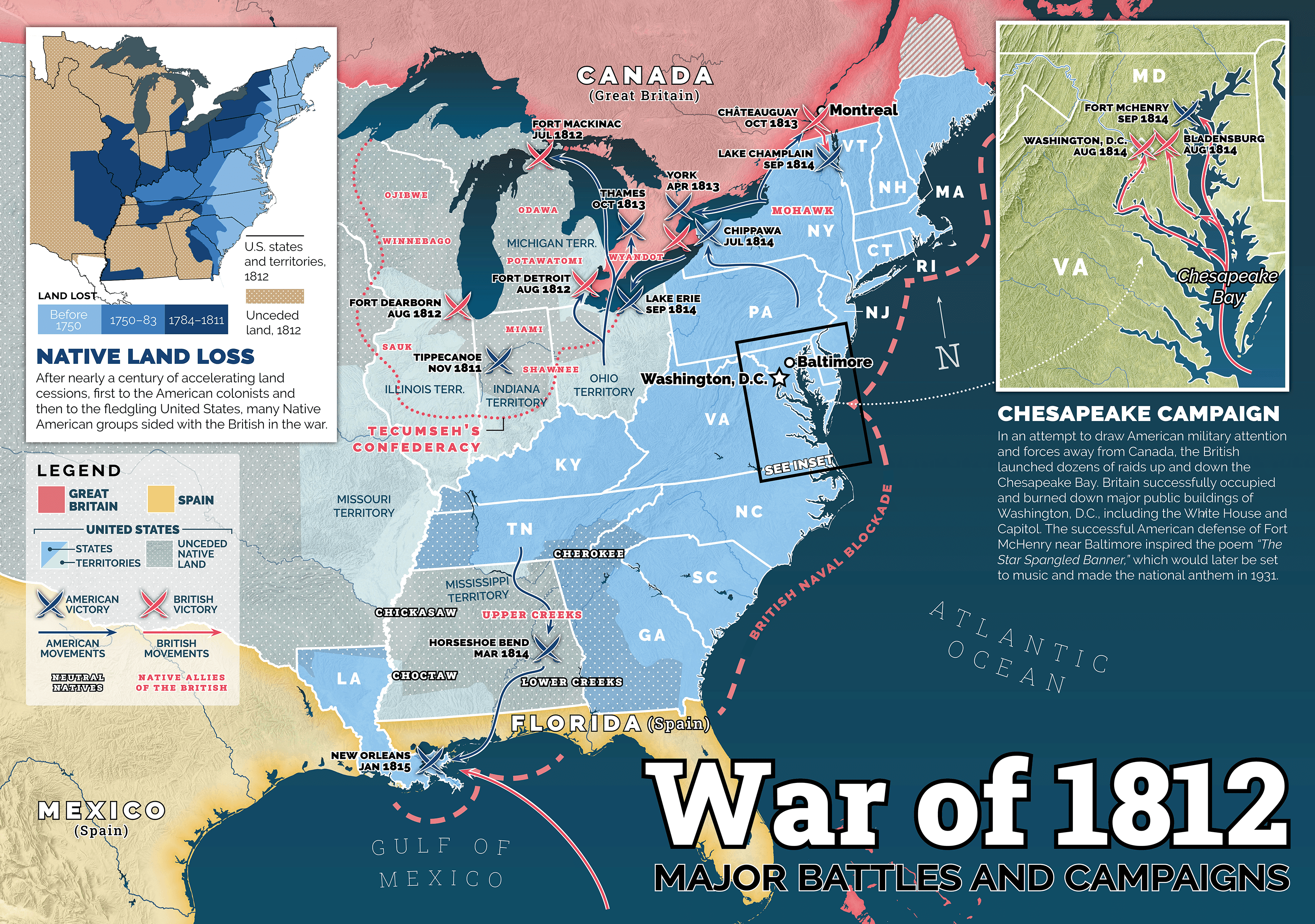
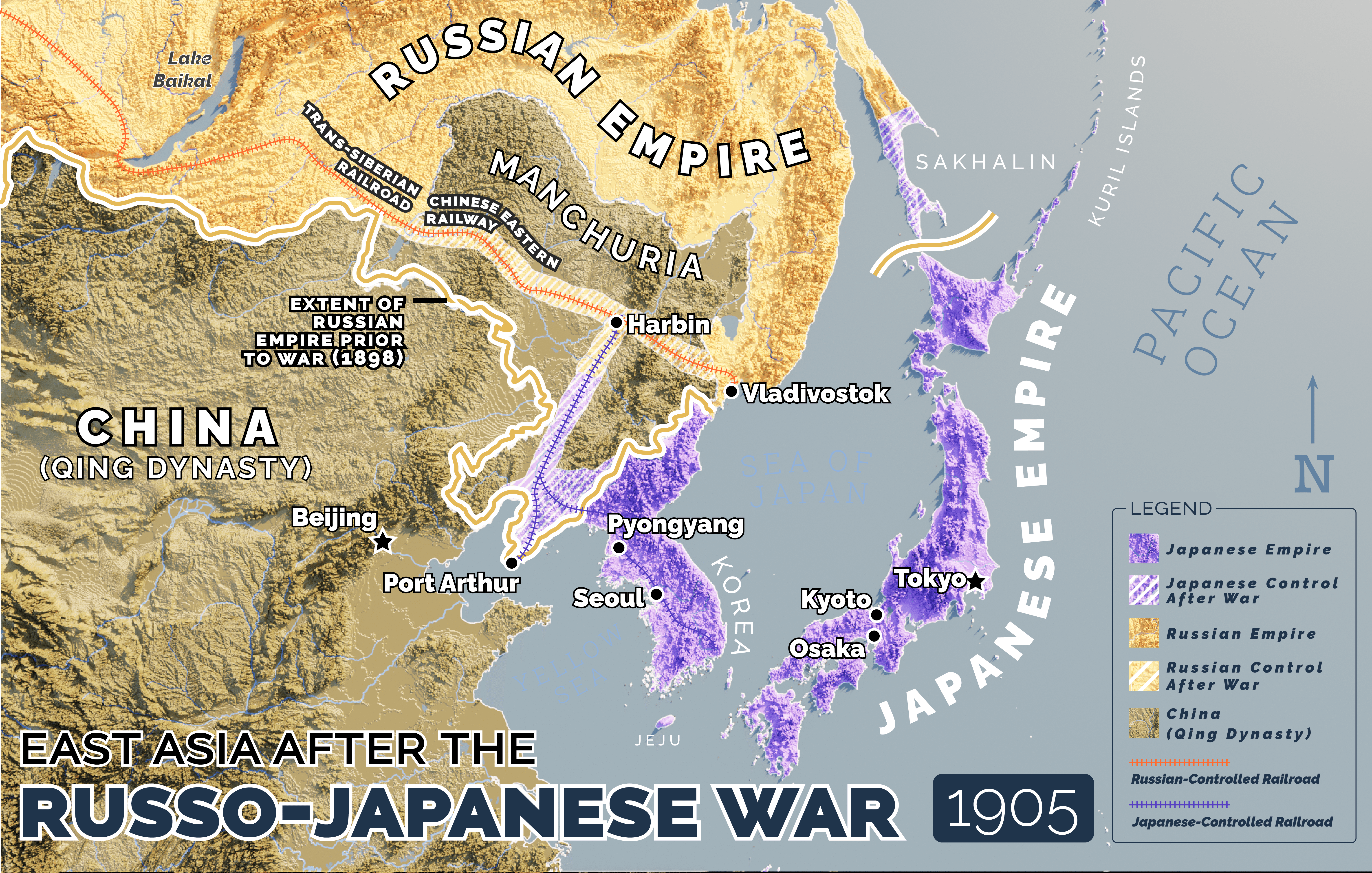
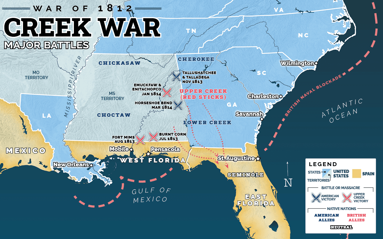
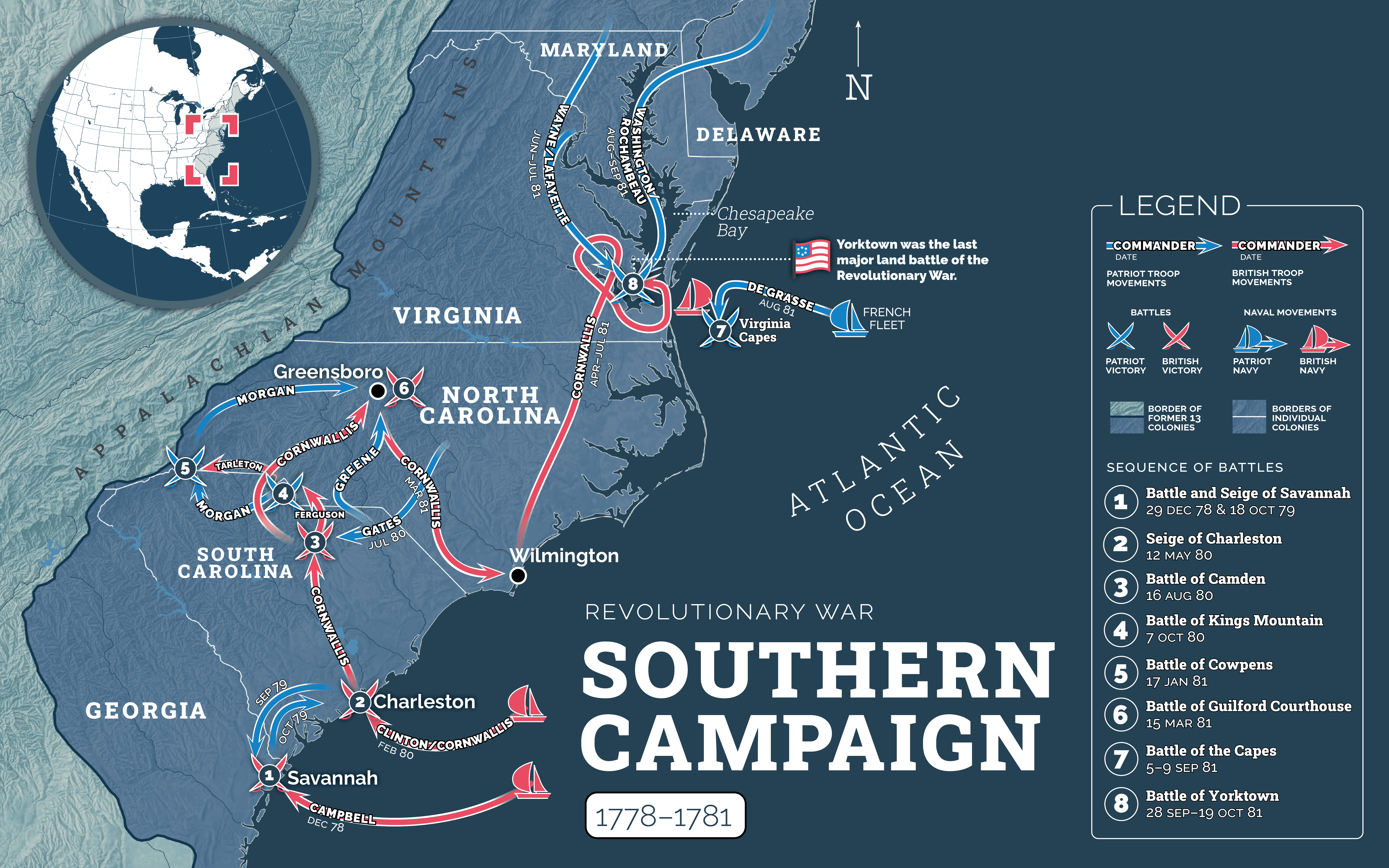
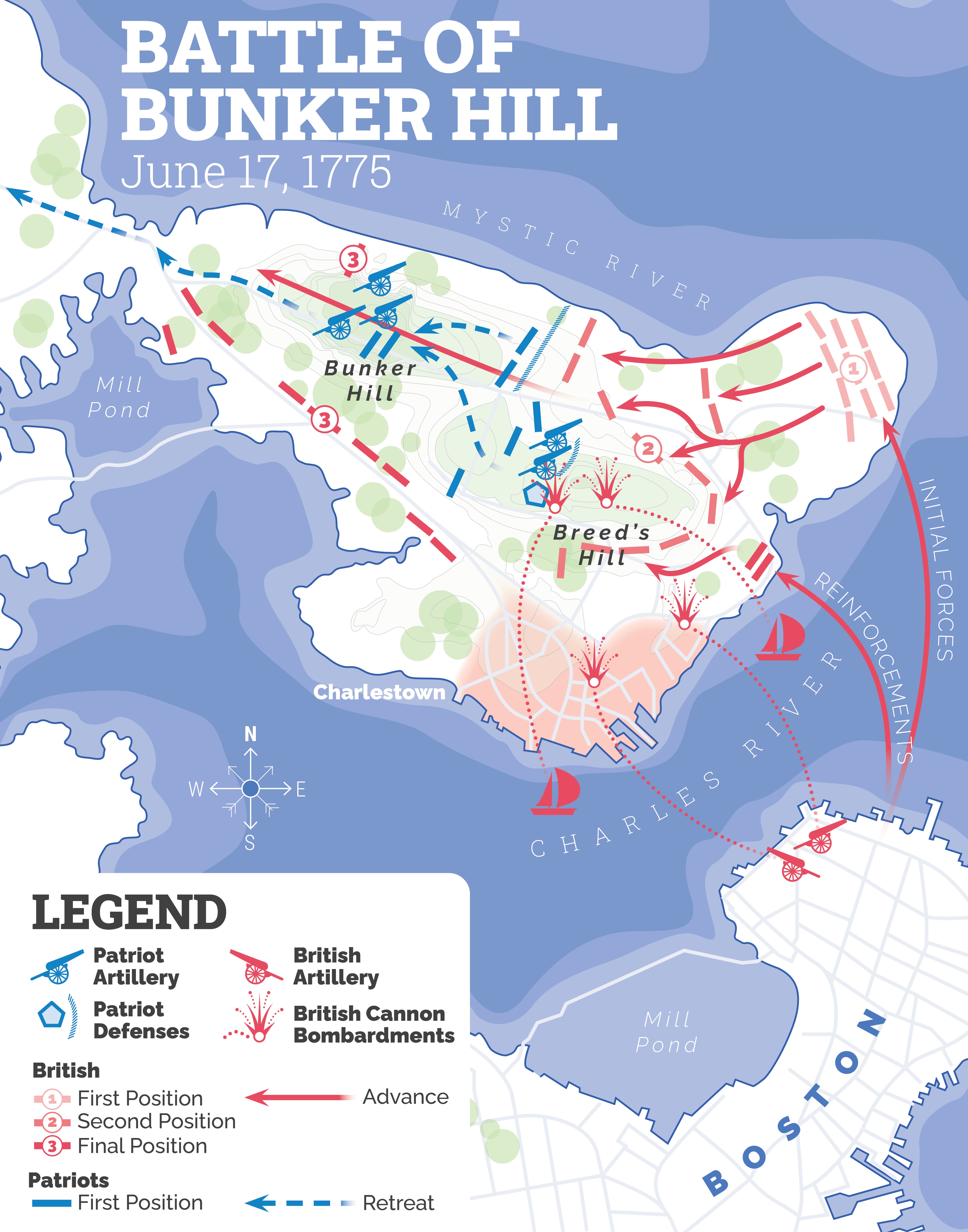
War and Battle Maps
A small selection of maps I made for the Story of America project that are war or battle-related.


RETURN
HOME